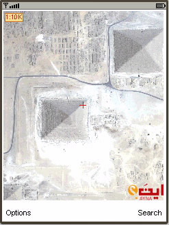
As promised when they first launched the mobile version of their mapping service, Ayna.com has gone on and launched a satellite imagery feature for this mobile version, allowing users to see a high-resolution aerial snapshot of the location they are looking for.
Users of the service can now enter any address in the Middle East on Ayna maps, and click on the “Satellite” link to locate and zoom into the wanted area till having the closest image.
The satellite imagery service on the mobile is empowered by DigitalGlobe technology and updated for 2008, allowing users to view the entire world and zoom into 26 Middle East and North African cities, with streets, malls, points of interest, geographic information, buildings and more, directly from their mobile phones.
The satellite map has the same features existing on the normal map: finding points of interest, getting directions, saving favorites, sharing with friends …etc.
The satellite imagery feature should also be available on the web version of Ayna maps soon.
